Disclaimer &
Copyright Notices; Optimized for the MS Edge
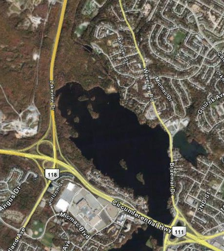
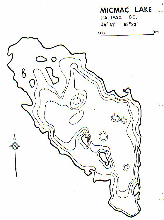
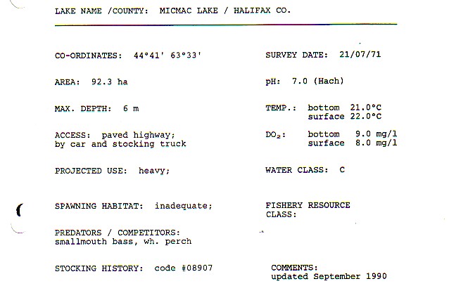
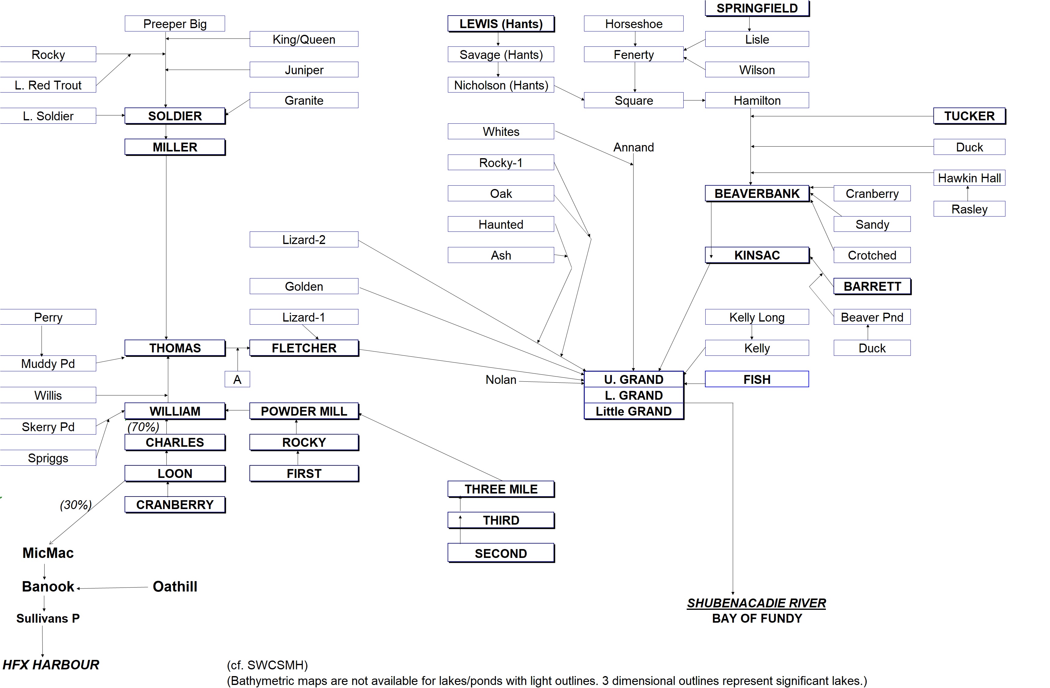
Lake
MicMac
Soil & Water Conservation Society of
Metro Halifax (SWCSMH)
Updated: June 28, 2018

- The
Shubenacadie song (i.e., the Stonemason's song), and the history of
the Stonemason's song; and
- Lifelike murals at the heavily travelled MicMac Parclo
in Dartmouth, Nova Scotia, Canada
Acknowledgements
Contents:

Select scientific modelling and chemical/biological limnology are part
of our miscellaneous
archives
The bathymetric map; the morphological data; the
Shubenacadie River watershed flow chart; the paleolimnology of lakes
in the HRM
Deep station total phosphorus (TP)- comparison with our hindcast models; October 18, 2013
Phosphorus:-
Details on LCC (Lake Carrying Capacity)/Threshold values of lakes, and
comparison with artificially high values chosen by the HRM; March 14, 2014
Public
concerns
Some of the following articles may be
relevant to the Shubenacadie
River headwaters as well and they are all related to the Shubie
Canal System
- Dartmouth fish kill caused by environmental stress; January 03, 2012
- Wading through the weeds: September 09,
2010
- Meeting tackles lake weeds: September
03, 2010
- Weedy Dartmouth lakes: September
01, 2010
- Silt run-off into Shubie Park brings construction to halt; October 12, 2005
- Mall project blamed after rainwashes silt into Shubie Canal; October 11, 2005
- Construction-site silt defiles Shubie Canal; September 20, 2005
- Rain stalls Burnside expansion; May 26, 2005
- Councillors fight over Burnside; May 25, 2005
- Lake Micmac run-off raises question; May 05, 2005
Acknowledgements
Google Earth for the maps!
