Disclaimer & Copyright Notices; Optimized for the MS Edge
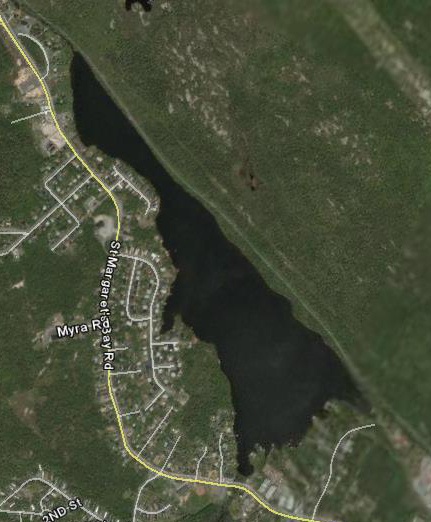
Governor Lake, Timberlea
Soil & Water Conservation Society of Metro Halifax (SWCSMH)
Updated: August 08, 2018 
Acknowledgements
Contents:
Chemical vs Biological monitoring

Select scientific modelling and chemical/biological limnology are part of our miscellaneous archives
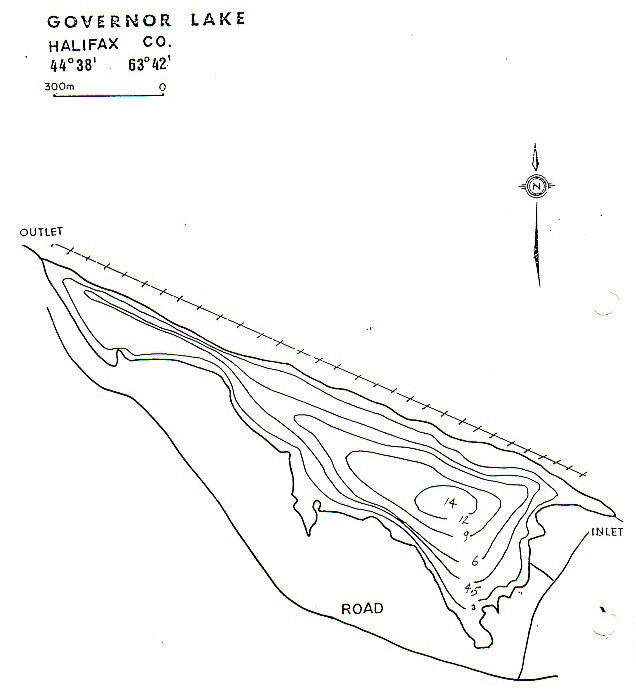
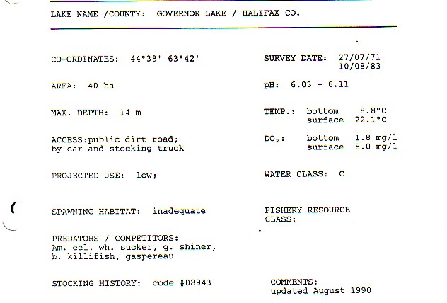
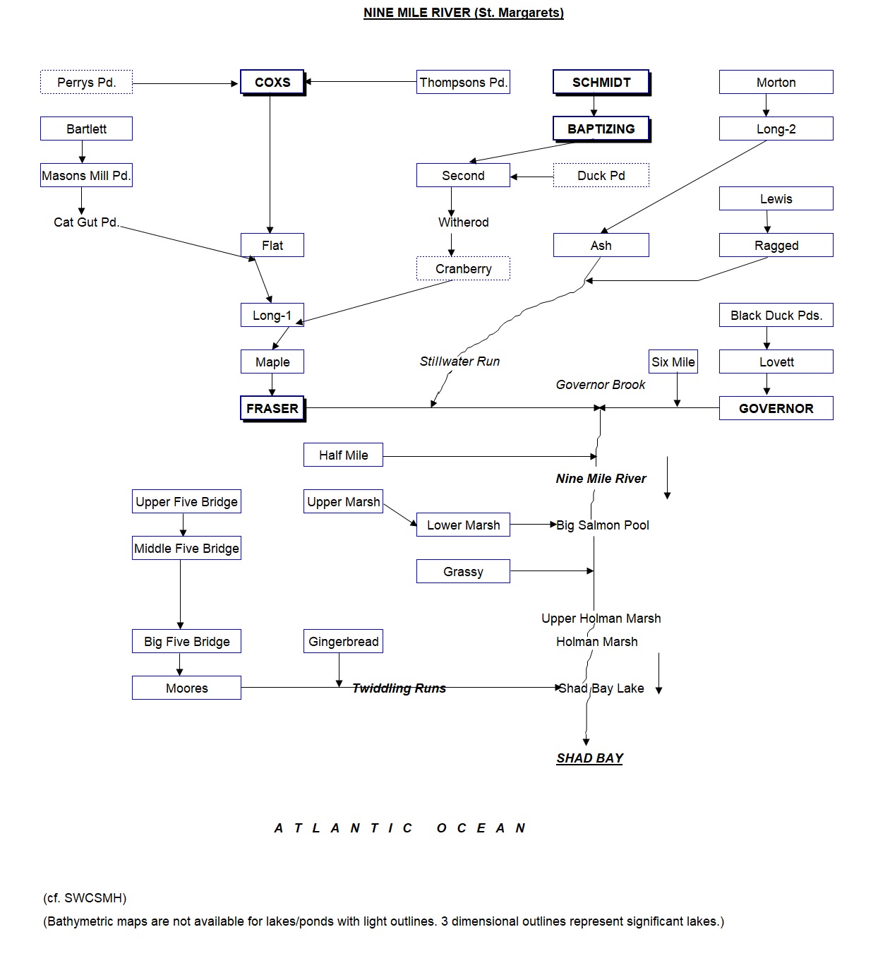
The bathymetric map; the morphological data; the Nine Mile River watershed flow chart, Western Region, HRM; peruse our predictive modelling, and view a relevant model; the Nova Scotia lake hypolimnion project; the paleolimnology of lakes in the HRM
- GOVERNOR LAKE,
Timberlea:- Significant cautionary signs apparent in the HRM’s
chlorophylla data of 2006-2011 in comparison with historical data;
d/September 06, 2013
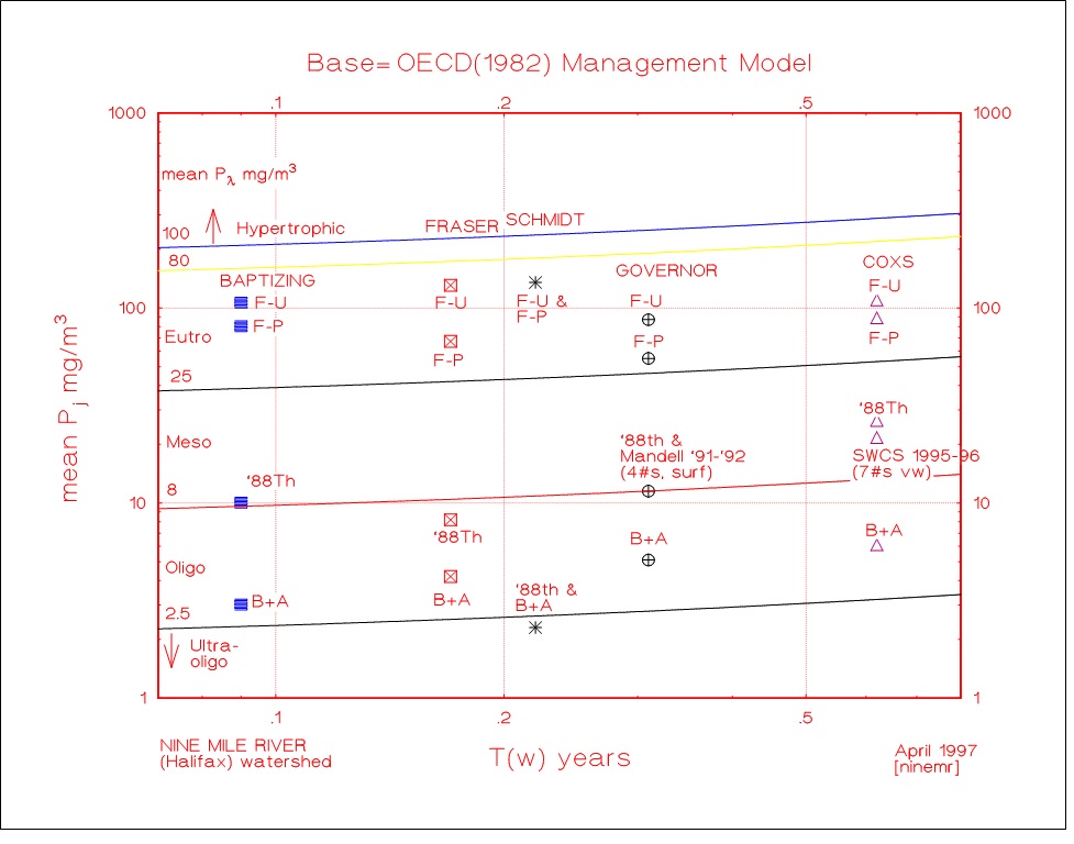
- Deep station total phosphorus (TP)- comparison with our hindcast models; October 18, 2013
- Phosphorus:- Details on LCC (Lake Carrying Capacity)/Threshold
values of lakes, and comparison with artificially high values chosen by
the HRM; March 14, 2014
Acknowledgements
Google Earth for the maps