Disclaimer & Copyright Notices; Optimized for the MS Edge
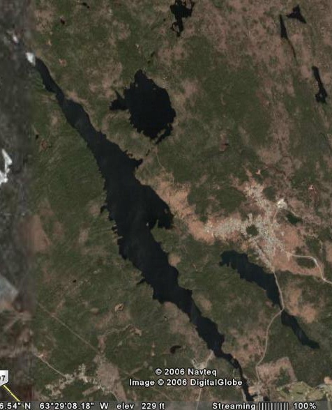
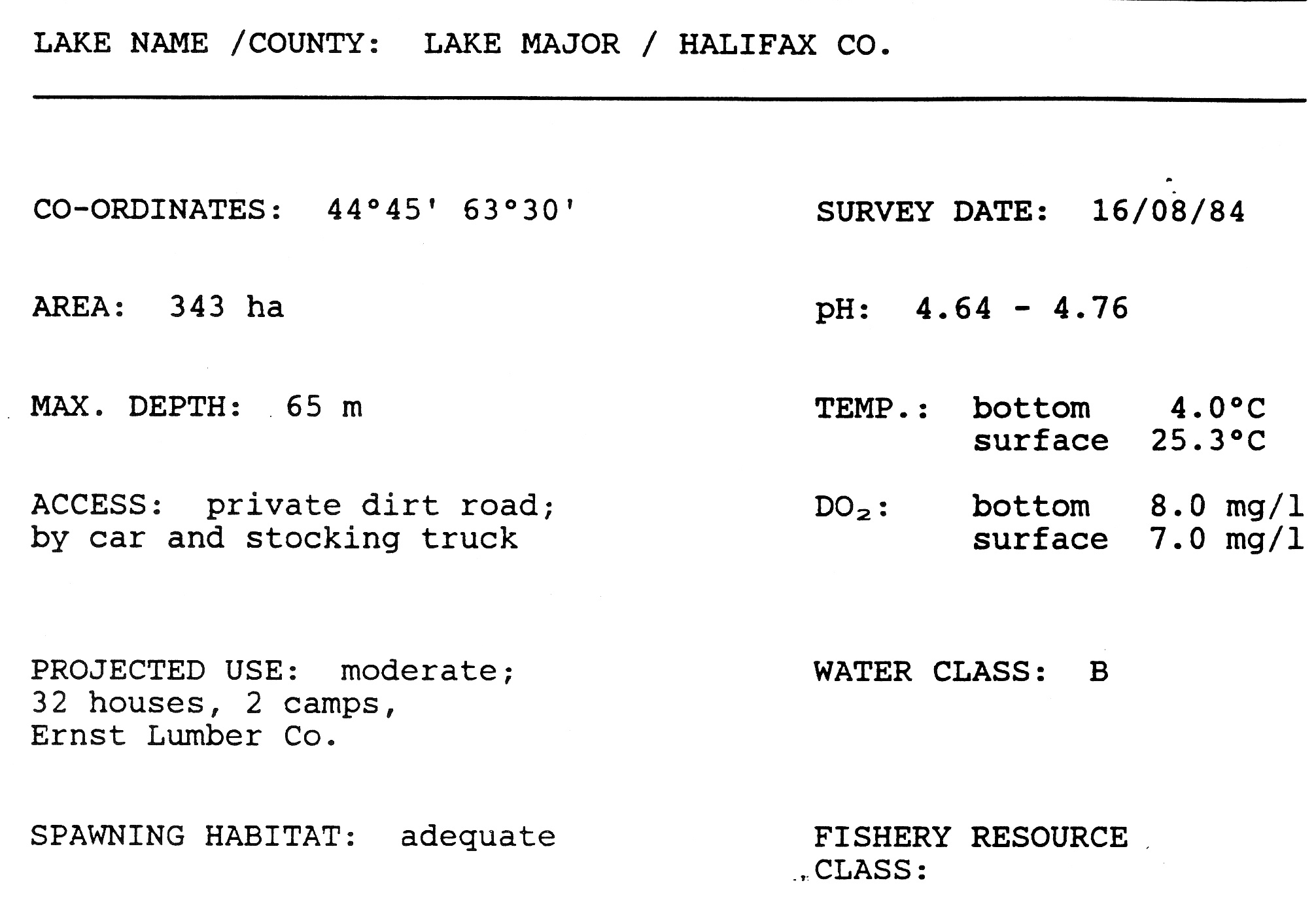
Lake Major
Soil & Water Conservation Society of Metro Halifax (SWCSMH)
Updated: August 04, 2015 
Acknowledgements
Contents:
Chemical vs Biological monitoring

Select scientific modelling and chemical/biological limnology are part of our miscellaneous archives
The morphological data; the paleolimnology of lakes in the HRM
Deep station total phosphorus (TP)- comparison with our hindcast models; October 18, 2013
Phosphorus:- Details on LCC (Lake
Carrying Capacity)/Threshold values of lakes, and comparison with
artificially high values chosen by the HRM; March 14, 2014
Lake Major watershed
The Halifax Regional Water Commission's website on watershed management: the Lake Major watershed-
7000 hectares. Approx. 2900 hectares are owned by the Crown and 2100
hectares are owned by HRWC. Approx. 1100 hectares are privately owned
including portions of the communities of North Preston, Cherrybrook,
and Montague Gold Mines. Approx. one third of the designated watershed
is part of the Waverley-Salmon River Long Lake Wilderness Area and is
protected from a variety of activites under the Wilderness Act. The Topsail/Lamont watershed (Cow Bay River watershed flow chart)
is part of the former water supply for the Dartmouth area. The
watershed is approximately 350 hectares and is located in the heart of
Dartmouth, north of Highway 7. The watershed is maintained as a backup
water supply.
Acknowledgements
Google Earth for the maps!